


Research project
OpenStreetMap 3D Germany
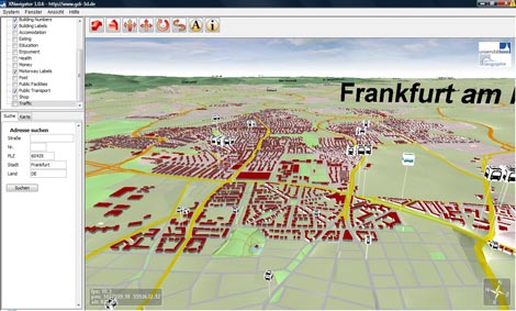
The user-generated geodata of OpenStreetMap (OSM) and the elevation data of the Shuttle Topography Mission (SRTM) are used for developing an open standard based 3D Geodata Infrastructure (GDI-3D) for entire Germany. A Web 3D Service (W3DS) is providing the processed data as a 3D scene graph to the client. The OpenStreetMap-3D project aims to investigate the following aspects:
- Use potential and quality of user-generated geodata
- Scalability of concepts and services developed in GDI-3D.de
- Integration of user-generated data into interoperable geodata-/geoservice infrastructures based on open standards
- Prototypical development of statewide GDI-3D (best practices)
- Interoperable platform for 3D city models
- Evaluation of cartographic visualisations in 3D
Editor:
Webmaster-Team
Latest Revision:
2018-12-03